Wild Weather Continues
Hello–
Many of you probably have Spring fever right now–and rightfully so, as it is Spring–on the calendar at least. We have been above normal this week by a slight bit, with the exception of yesterday when we were quite a bit above normal. We are about to get some active weather leading us into the weekend, and we may even conclude the weekend with some snow. Don’t put away the shovel yet, as that may not be our only chance. Last year we were shoveling in May, so I guess it isn’t anything new.
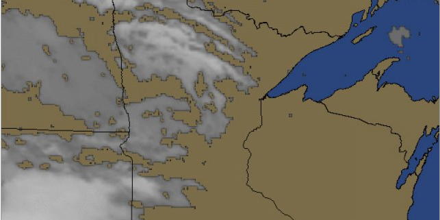
The dynamics in Southern MN may coming together enough for some strong and even marginally severe storms on Saturday. We may see a couple of waves of precip, and then another wave overnight Saturday into Sunday. The timing is still unclear for Sunday, but if the cold air ushers in fast enough with some remaining precip, we may see a bit of snow. Most models have it being primarily east of us, but some of the others, such as the NAM model have us getting a narrow band of heavy wet snow on Sunday AM.
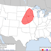
This is the Day 3 outlook from SPC regarding the possibility of Severe Storms on Saturday. This may be expanded and modified tomorrow.
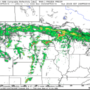
This is what the NAM shows for possible snow on Sunday AM—a narrow band, but fairly heavy in concentration.
Before the above mentioned snow moves in–we have a chance at some early AM and also some afternoon storms on Saturday. Some of these may be severe to the south, with damaging winds and large hail.
Here’s the probability of more than a 1/10″ of precip from 2am Sat thru 8pm Sat–related to the QPF.
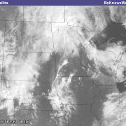
The above graphics–if anything, also give a good idea of the general timeline of precip. The first image shows lighter precip, when we may have rain and storms overnight. The next two images seem to highlight a potential line of cells or a squall that would form in E and SE MN–and then extend SW into N IA and E NE. This is just a possibility, but seems like a likely scenario at this point. The next push of moisture late Saturday will likely come from a secondary low and would then pass through along with the next wave of colder air, and could bring with it some snow. It’s worth watching.
Here’s my thinking for Southern MN–in regards to possible Severe Weather. I think other than heavy rain and small hail–the risk for Severe WX may be primarily S of MSP–but that could change. A majority of our precip could fall in colder overnight conditions. A secondary line may develop in the late afternoon. It is worth watching as we get closer.
Here’s the 7-day updated forecast for MSP. As you can see, we will be cooling off below normal again. We will be watching a few close calls for snow chances as well.
Thanks for checking in. Stay tuned as we get closer to Saturday and Sunday, as we highlight potential severe weather chances, as well as potential snow chances. Follow on Twitter @BoKnowsWeather and Facebook–Facebook.com/BoKnowsWX for regular immediate updates.
-Bo

