


October 2015
Happy Saturday!
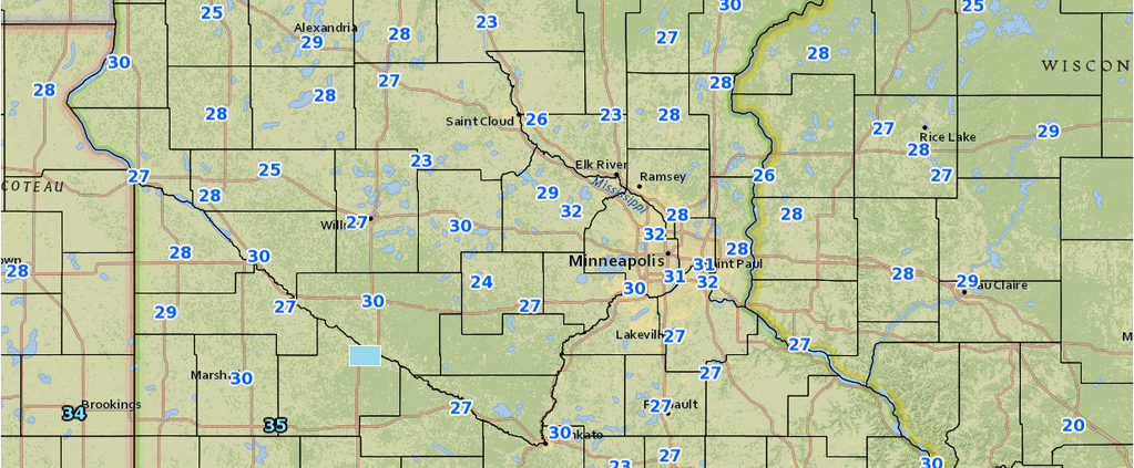
The roller coaster of fall temps continues! We had a hard freeze last evening in the metro and nearly all of MN–so if you left any plants outside, they may be in trouble. Even though we got cold, and remain cold today, we start to moderate tomorrow through Monday. Monday will be a warmer day. This time of year, usually the warmer days are quite windy also, so keep that in mind. Some parts of SW MN could be in the mid 70’s to near 80 on Monday. In MSP, upper 60’s to low 70’s look possible. Some indications are that it could be even warmer. Read more
Severe Weather Risk on Sat 8/22
Hello-
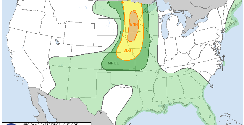
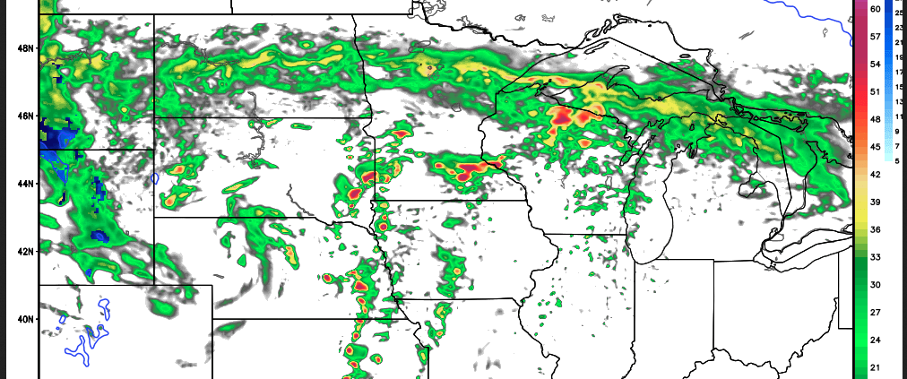
Thanks for checking in. There’s been a lot of chatter about the Severe Weather Risk for Tomorrow (Saturday 8/22/15), and for good reason–it seems like it could be an active day. The NAM & GFS seem to have a good handle on it, and soon, some of the short term high-res models will be coming into play. For the sake of highlighting the event, I am taking a look at the NAM below–and giving a brief and to the point overview. Many other factors come into play, and other models/data etc, but for the sake of simplicity here, I am just showing one. Read more
August 2015
Hello all–
Are you enjoying the summer so far? It sure is cooler than normal. Each year we average about 15 days or so above 90F, and this year, I believe we have only had 2 officially at MSP! Each year goes in waves. As we have a pretty strong El Nino going on now–this may end up taking us into a milder winter. Anyways–enough talk about winter. Our Severe Weather load has been noticeably lighter as well–and I am sure many of you are ok with that! Read more
Update on Severe Weather Expectations Today
SEVERE WEATHER POSSIBLE TODAY!!! See below for an extended write up!
Hello-
If you checked in several days back, I had been talking about some severe weather possibilities for this weekend. Here we are on the day this event is supposed to happen.
Just last evening, the SPC had put out a 10% probability of Tornadoes in IA & E NE, and 5% for Southern MN. That refers to the odds of tornadoes in the vicinity of any given point based on mileage. Anyways–that number has since been reduced again today.
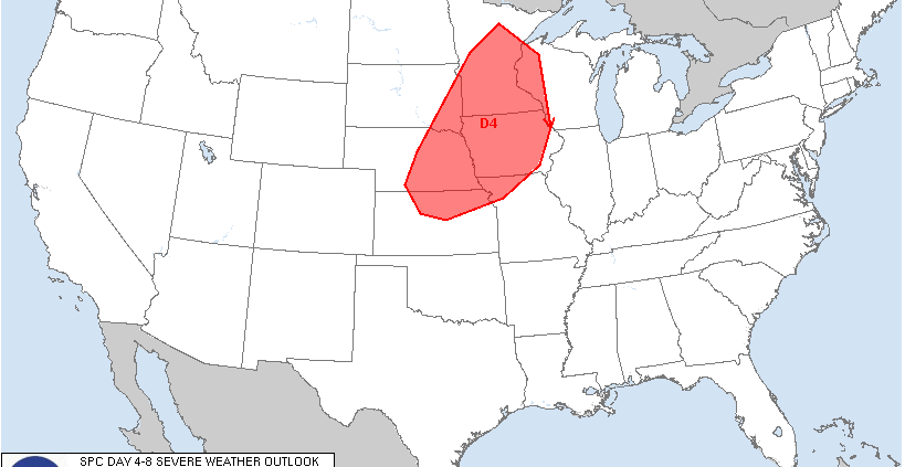
Labor Day weekend Severe Weather?
Potential Severe Weather this weekend!
Thanks for checking in!
The title isn’t meant to scare you, but we do have the possibility of some Severe Weather this weekend in the Upper Midwest & Minnesota–particularly on Sunday. It still is a bit of a ways out, but it is worth watching. The interesting thing to note is that this potential event has come up on the day 4-8 Outlook from SPC (Storm Prediction Center)–for both Day 5 and Day 4. The next day or so should provide more clarity on the situation. The wording of Supercells and Tornadoes has come up, and it surely has generated a bit of buzz.
Wild Weather Continues
Hello–
Many of you probably have Spring fever right now–and rightfully so, as it is Spring–on the calendar at least. We have been above normal this week by a slight bit, with the exception of yesterday when we were quite a bit above normal. We are about to get some active weather leading us into the weekend, and we may even conclude the weekend with some snow. Don’t put away the shovel yet, as that may not be our only chance. Last year we were shoveling in May, so I guess it isn’t anything new.
March 2014: The Blog is Back!
Hello Friends and Followers!
I took a long absence from the blog (last post was October 2013), as I have had a very full plate, and the tail end of the schooling has consumed me. I thought today would be a good day to bring it back to highlight the weather for the week ahead. As many of you have also noticed, I had been working on getting my new graphics rolled out–snowfall charts, 7-day forecasts, etc. Unfortunately the blog became a victim of the balance of time.
Meteorological Spring started on March 1st, but traditionally we have to wait until the third week of March, when the suns rays are directly over the equator.