October 2015
Happy Saturday!
The roller coaster of fall temps continues! We had a hard freeze last evening in the metro and nearly all of MN–so if you left any plants outside, they may be in trouble. Even though we got cold, and remain cold today, we start to moderate tomorrow through Monday. Monday will be a warmer day. This time of year, usually the warmer days are quite windy also, so keep that in mind. Some parts of SW MN could be in the mid 70’s to near 80 on Monday. In MSP, upper 60’s to low 70’s look possible. Some indications are that it could be even warmer.
Here’s a look at how cold we got last night–officially. Graphic courtesy of NWS Twin Cities (Twitter page).

Overnight Lows: Hard Freeze
Parts of the UP of Michigan got almost 6″ of snow last night. Not completely unheard of–but certainly a wake up call! A trough is allowing that cold air to pour down over the eastern half of the US, setting the stage for snow showers and even some accumulating snow. We are also coming up on the time when Lake Effect Snow becomes an issue! As cold air flows over the lingering warm water in the Great Lakes, you will get Lake Effect Snow bands setting up. Some minor bands with this early season cool-down are what caused this snow in the Great Lakes area and Northeast, but over the next few weeks, you can bet that this will be increasingly common. Here is the general process below…Source: COMET program.

Lake Effect Snow
You may have been seeing a lot of posts about how the strong El Nino could be giving us a warmer and less snowy winter. Warmer may be possible and more likely, but statistically, the odds of less snow are about 50/50 when compared to historical references. So–don’t put your shovel and snowblower too far into the back of the garage. Precipitation chances are more variable in these strong ENSO events.
This graphic shared by NWS Twin Cities recently highlights it:

Winter Statistics
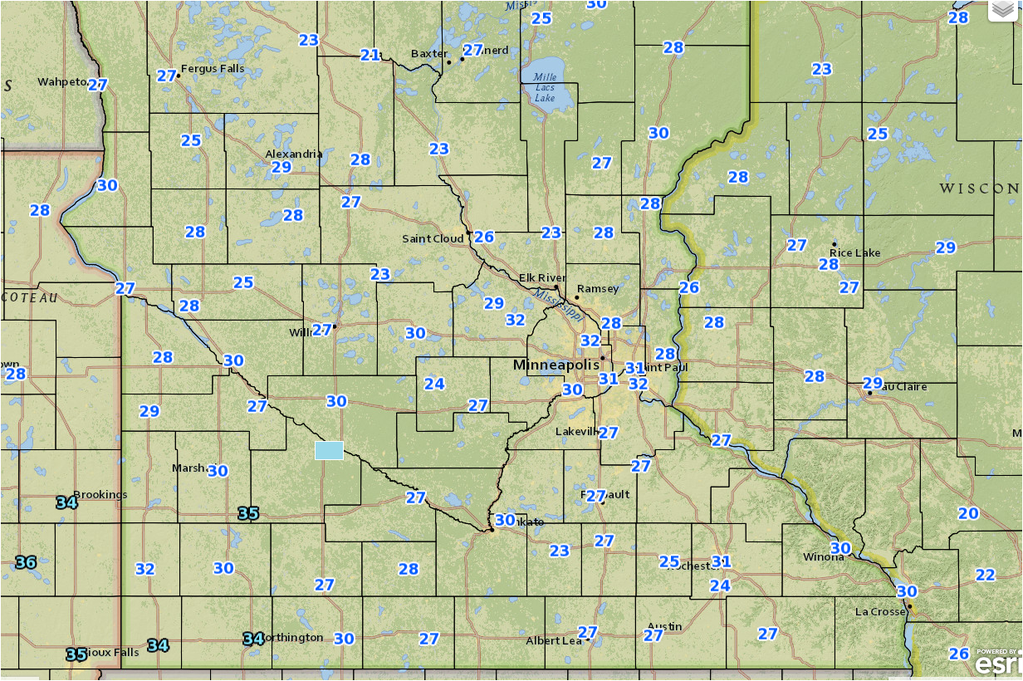
Coming up for tomorrow and Monday, here’s what we could be looking at for highs over the area:
Sunday:

Possible Highs according to 4k NAM
Monday:
Possible Highs Monday according to NAM 4k
I will be making some changes to the BoKnowsWeather site page soon–including a new interactive chaser camera page, and a Responsive forecast page, in addition to the maps that remain on there now. www.boknowsweather.com
Thanks for checking in. Please continue to follow @BoKnowsWeather on Twitter and Instgram, and also Facebook.com/boknowswx
I appreciate all of you.
-Meteorologist Bohdan Cole


