Weather Update: July 20th-July 22nd
Hello-
My apologies for a long gap in posts. I was upgrading my site, and was moving, so there was some downtime with my Internet as well.
Here is your updated weekend forecast for Minnesota through Monday 7/22:
Here are your High and Low Temps Forecasts for Each Day through Monday, and also your precipitation forecasts. Also, after this, I will discuss the severe weather potential for Monday in MN.
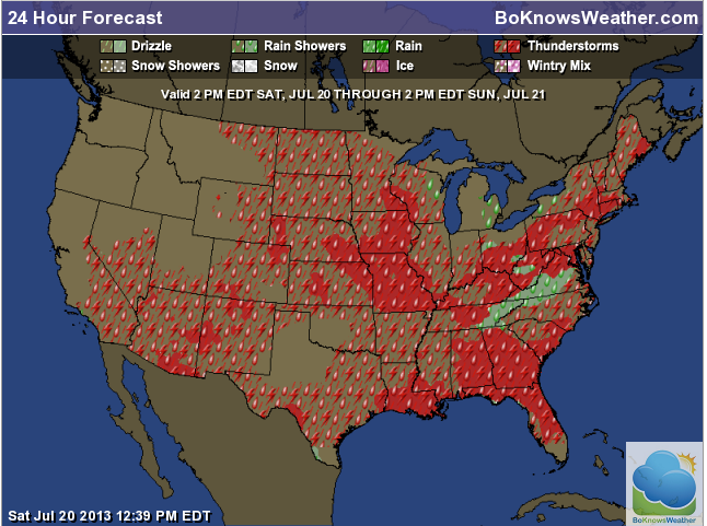
July 20th through 22nd Outlook–Precipitation & Temperatures:

Precip Outlook Sat Through Sunday

Precip Outlook Sun through Monday

Saturday Highs

Sunday Highs

Monday Highs

Saturday Lows

Sunday Lows

Monday Lows
SEVERE WEATHER POTENTIAL ON MONDAY:
There is an increasing chance of Severe Weather in Southern MN on Monday.
Temperatures: Temps will be near 90 in Southern MN…plenty of warmth for Severe Storms.

Temperatures
Dewpoints: Will likely be up into the 70’s in Southern MN. Plenty of fuel for the storms to initiate.

Dewpoint
Jet Stream Winds: The Winds are Moving directly overhead contributing to the instability and wind shear.

Jet Stream Winds
CAPE: Quite high, with values above 4000 J/Kg.

CAPE
WIND SHEAR: The Red lines indicated surface winds, and the blue refers to winds aloft. They change direction with height, which is what we call wind shear–and this helps with the formation of tornadoes.

WIND SHEAR
LIFTED INDEX: These values are above the typical threshold for Severe Weather as well…so development could be explosive if the CAP is not too strong.

LIFTED INDEX VALUES
Stay tuned to this blog for updates based on the changing models through the weekend.
Thanks for visiting!
Bo


