September 2nd thru September 8th
Hello-
There has been a long gap in posts–my apologies. I have been mostly on Twitter due to my busy schedule. The weather tends to wind down a bit in the fall in the Upper Midwest. Aside from a few severe weather instances and the heat wave, things haven’t been terribly intense here. After a brief cool down on Sunday and Monday (Today)–we should begin to moderate again for the week. September–just like the month of March, happens to be one of our biggest changing weather months, when the Sun goes through it’s most rapid transition with it’s angle of inclination and solar radiation output.
Translation–by the end of the month, things should begin cooling down rather dramatically, and our chances of severe weather will also diminish as well. We have had severe weather as late as November, but our chances are slimming quite a bit by the fall–which officially arrives on 9/22. Meteorological Fall actually came on 9/1–which essentially means our beginning of our cooler period.
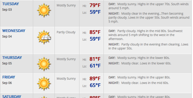
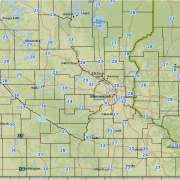
Here are some updated maps to highlight the weather we expect this week. Other than some small chances of showers in S MN on Tuesday, it should be a fairly dry week up until late Saturday/Sunday, when we see more chances of storms. If there is a risk of severe weather on the weekend, I will keep you updated as well–as it seems we are in store for a fairly dramatic cool down on Sunday, after some heat and humidity on Saturday.
Here are some precipitation and temperature maps for the Upper Midwest:
Stay with us here at BoKnowsWeather.com and on Twitter @BoKnowsWeather. Facebook also will have updates at www.facebook.com/boknowswx.
Enjoy the last bits of summer and early fall!
-Bo

