Tag Archive for: Severe Weather
Severe Weather: Wed July 11th/Thu July 12th
/in Blog, Current Weather/by adminPosted: 8:30pm Wednesday 7/11/18.
It’s been a long time! As you can see- I just launched a new website here, and I plan to keep up the blog more- I promise!
Now- on to business.
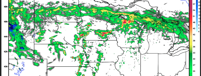
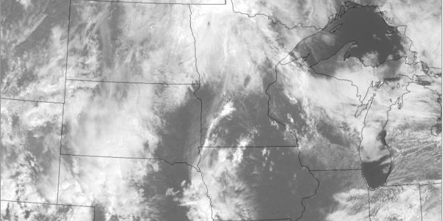
Severe weather may be an issue overnight Wednesday into Thursday, and depending on how much leftover AM convection (storms) and cloudcover we have, it could alter the dynamics for Thursday. As of just recently, a Tornado Watch was issued for Northern Minnesota- so it looks to be a long evening up there.
First shot at Severe Storms on Sunday
/in Blog/by adminHey everyone-
I hope you’re enjoying Spring so far. It seems pretty typical for MN to me. Random warm streaks, followed by cool–all of the stuff that often makes us question why we all live here. Don’t worry–we should be thru that soon enough.
The streets have been swept and neighborhood gardens planted–it has to stay warm now, right? :)
The first shot at ‘Marginally’ Severe storms could show up for Southern MN tomorrow (Sunday 4/24). Just enough humidity creeping up along a warm front, and enough dynamics nearby to create some potentially severe storms. Read more
Severe Weather Risk on Sat 8/22
/in Blog/by adminHello-
Thanks for checking in. There’s been a lot of chatter about the Severe Weather Risk for Tomorrow (Saturday 8/22/15), and for good reason–it seems like it could be an active day. The NAM & GFS seem to have a good handle on it, and soon, some of the short term high-res models will be coming into play. For the sake of highlighting the event, I am taking a look at the NAM below–and giving a brief and to the point overview. Many other factors come into play, and other models/data etc, but for the sake of simplicity here, I am just showing one. Read more
August 2015
/in Blog/by adminHello all–
Are you enjoying the summer so far? It sure is cooler than normal. Each year we average about 15 days or so above 90F, and this year, I believe we have only had 2 officially at MSP! Each year goes in waves. As we have a pretty strong El Nino going on now–this may end up taking us into a milder winter. Anyways–enough talk about winter. Our Severe Weather load has been noticeably lighter as well–and I am sure many of you are ok with that! Read more
Update on Severe Weather Expectations Today
/in Blog/by adminSEVERE WEATHER POSSIBLE TODAY!!! See below for an extended write up!
Hello-
If you checked in several days back, I had been talking about some severe weather possibilities for this weekend. Here we are on the day this event is supposed to happen.
Just last evening, the SPC had put out a 10% probability of Tornadoes in IA & E NE, and 5% for Southern MN. That refers to the odds of tornadoes in the vicinity of any given point based on mileage. Anyways–that number has since been reduced again today.
Labor Day weekend Severe Weather?
/in Blog/by adminPotential Severe Weather this weekend!
Thanks for checking in!
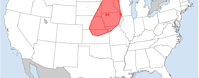
The title isn’t meant to scare you, but we do have the possibility of some Severe Weather this weekend in the Upper Midwest & Minnesota–particularly on Sunday. It still is a bit of a ways out, but it is worth watching. The interesting thing to note is that this potential event has come up on the day 4-8 Outlook from SPC (Storm Prediction Center)–for both Day 5 and Day 4. The next day or so should provide more clarity on the situation. The wording of Supercells and Tornadoes has come up, and it surely has generated a bit of buzz.
March 2014: The Blog is Back!
/in Blog/by adminHello Friends and Followers!
I took a long absence from the blog (last post was October 2013), as I have had a very full plate, and the tail end of the schooling has consumed me. I thought today would be a good day to bring it back to highlight the weather for the week ahead. As many of you have also noticed, I had been working on getting my new graphics rolled out–snowfall charts, 7-day forecasts, etc. Unfortunately the blog became a victim of the balance of time.
Meteorological Spring started on March 1st, but traditionally we have to wait until the third week of March, when the suns rays are directly over the equator.
Two storm chances next week–changes likely in forecast!!
/in Blog/by adminHello-
The models have been hinting at two large storms next week–or, what we are really seeing is the likelihood of one large storm in multiple waves, split up like two separate storms. These are generally impulses that spin up off of the main low pressure center—so we usually see multiple waves. This is fairly common of large storms of this nature.
The ECMWF runs yesterday were pulling the brunt of the storm over MN near Halloween, with a preliminary part of the storm on Tuesday. Now, the normally reliable ECMWF seems to pull it further away on Halloween and after.
Outlook for MN: First Snow Chances
/in Blog/by adminHello-
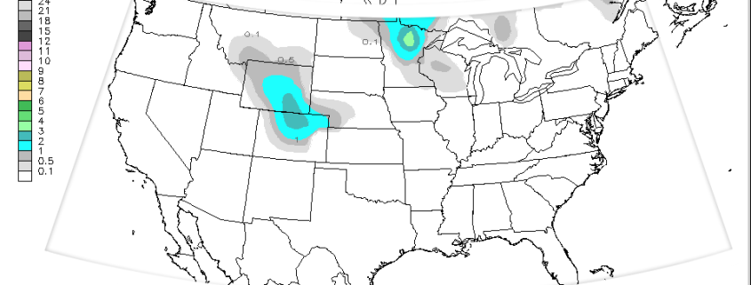
You have probably been hearing of snow chances on your local news forecasts… and yes, it is looking more and more likely.
Change happens quickly in Minnesota this time of year. We can go from late season severe weather to early season snowfall like the flip of a light switch. For those of you that didn’t know, South Dakota and Wyoming have already been blasted by some early season snowfall–measured in FEET. Some places got upwards of 4 or 5 feet, with drifts that buried homes, and killed over 100,000 animals/cattle. We won’t see anything like that, but the first couple of snowfalls always seem to generate some buzz–and certainly some unwanted excitement on the roads.
Information
Your trusted source for 24/7 weather information!
We provide a closer look at Minnesota where we are based out of; but we do also provide National/US Forecasts and insights.

Connect With Us
Follow on Twitter
bo@boknowsweather.com


