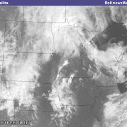
Severe Weather: Wed July 11th/Thu July 12th
Posted: 8:30pm Wednesday 7/11/18.
It’s been a long time! As you can see- I just launched a new website here, and I plan to keep up the blog more- I promise!
Now- on to business.
Severe weather may be an issue overnight Wednesday into Thursday, and depending on how much leftover AM convection (storms) and cloudcover we have, it could alter the dynamics for Thursday. As of just recently, a Tornado Watch was issued for Northern Minnesota- so it looks to be a long evening up there.

Also- a Slight Risk of Severe Weather Remains up there- along with the active Tornado/Hail and Damaging Wind threat- as well as torrential rains.
Slight Risk Area:

Tornado Risk Area this Evening (Wed):

Damaging Wind Risk Area:

Large Hail Risk Area:

Additionally- and this could be one of the largest concerns for saturated soils- as you can see- we have a Moderate Risk of Excessive Rainfall- which is defined as “Risk of 1 to 6 hour rainfall exceeding flash flood guidance at a point”

At the current time, however- it looks like we have a decent shot at storms in Southern MN on Thursday. A more important consideration here is the issue that some storms may ‘train’ over the same areas- like train cars on a track, and this could be VERY impactful for areas that have seen flooding issues in recent days. If you have had an abundance of rain/flooding issues, you will want to stay extra close to the latest updates, and stay tuned for watches and warnings.
The Storm Prediction Center has us in Slight Risk of Severe Weather for Thursday and also Tomorrow- Thursday- we have a slightly lesser Risk of Excessive Rain, but the risk is still there, as seen below.

Here’s the Slight Risk of Severe Weather in place for Thursday also:

As for tonight- a change of storms seems very likely, now that the atmospheric cap is breaking, and we may see some development, especially after dark.
Here’s a potential radar/simulated radar scenario for next 60 hours, as depicted by the NAM3K

As always- weather is constantly changing- and things will likely need to be updated again tomorrow on here. Stay tuned for updates. Don’t forget to download my app from the iOS app store or Google Play store if you haven’t already. Also- follow me on Twitter @BoKnowsWeather, and my automated alert feed for the MSP and surrounding county area @BoKnowsWXAlerts, and also on Instagram @BoKnowsWeather. I’ll soon be doing some IGTV updates on that new channel there as well. http://boknowsweather.com/mobile-apps/
If you ever have any feedback, suggestions, or weather needs- drop me a note here! I often help guide people in the winter time, or even in the summer for their business needs as they relate to weather, forecasting and timing various activities out, to help them plan strategically and stay ahead of their competition. http://boknowsweather.com/contact-bo/
Stay close!
-Meteorologist Bohdan Cole


